Everything you need to plan missions, automate your operations, track program activity and analyze your data.
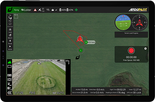
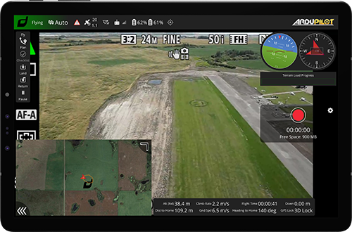
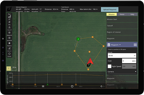
Draganfly’s DGroundControl software is a powerful flight planning tool that provides simple templates for multiple operational types, including grid survey, corridor mapping, and orbital structure scan, while still giving full control for in-depth automated flight commands. DGroundControl software supports all current Draganfly UAV platforms and provides users with flexible flight planning and execution capabilities. The user interface dynamically updates automatically depending on the aircraft and payload to give users the controls they need while reducing unneeded clutter.
Designed and manufactured in North America.
Designed and manufactured in North America.
This simple, easy to use software is supplied with all Draganfly UAV platforms and includes a Software In The Loop simulator for training and development of real-world flight operations.
Key Features
Key Features
Import shapefiles (.kmz, .shp) to ensure target flight area is captured.
Automatic adjustment of flight speed and shutter interval based on camera specs to ensure reliable data collection.
Pause and resume automated missions to support battery changes for large coverage area operations.
Quick access buttons for Return to Launch, Smart Return to Launch, and Land Now features to aid with ease of operation.
Automated payload target tracking for both static and moving objects (with supported payloads).
Built in automated preflight checklists.
No internet connection required for field flight operations.
Optimized for use on Windows and Android OS.
Real time video link and customizable telemetry display so the PIC can closely monitor all aspects of the mission.
The Pix4D drone software suite is the premiere drone photogrammetry solution for UAV-based data collection. Extremely powerful and easy to use, Pix4D’s products create flexible outputs used in countless applications for a wide range of industries including agriculture, mining, environmental monitoring, emergency services, construction, and more!
Pix4D transforms aerial photographic data collected into geo-referenced 2D orthomosaics, Digital Terrain Models (DTM), 3D models, and vegetation indices. Pix4D creates highly accurate models to measure, evaluate, and visually review the data, which can also be exported for use in most other third-party GIS programs.
Reach out to a Sales Specialist today to learn more about our Custom Solutions.
Reach out to a Sales Specialist today to learn more about our Custom Solutions.
Contact our team to discuss our ready-to-ship, turnkey commercial drones and custom solutions.
Tim Dunnigan
ADVISOR
Tim Dunnigan is a thought leader and serial entrepreneur who served 22-years in the U.S. Army
as a Soldier, NCO, and Commissioned Officer where he filled a myriad of dynamic leadership
roles and global assignments, including three combat tours of duty. His 20-years of
entrepreneurial success is guided by transformational ideas and ventures in technology,
innovation, and education. Tim is the CEO & Founder at CaptureTec, LLC – a Center for
Verification and Evaluation Certified, Service-Disabled Veteran-Owned Small Business (CVE
SDVOSB) focused on leadership consultation, systems integration, and solutions that provide
data capture for infrastructure assets using aerial, static, and mobile scanning technologies. As
the COO and Co-founder at Talon Aerolytics, Tim architected the nation’s largest aerial drone
services provider from inception to all 50 states serving clients including AT&T, Nokia, T-Mobile,
Ericsson, and Verizon. As the CEO & Founder at Strategic Integration (CVE SDVOSB), Tim
developed the CTED (Create, Test, Educate, Deploy) turnkey business model for defense
consulting and technology integration, while serving America’s interests abroad through multiple
U.S. DoD classified hardware and software contracts in the U.S. and overseas. Additionally, Tim
is the Founder of Innovalearn, where he created education content for clients including Aflac,
Synovus, Subway, and Cox Communications; the Founder of iK9 (CVE SDVOSB), where he
co-authored the Veterans Administration (VA) training protocols for service dogs for Veterans
with PTSD; and the Co-founder of GameLink Lounge, where he architected innovative
entertainment concepts for Service Members and their families on Military installations across
the U.S.
Tim is also the Founder of the I’m a Hero Too Foundation [501(c)(3)] and a children’s book
author. He holds a Bachelor’s Degree in Human Development, a Master’s Degree in
Organizational Leadership and Management, and has completed 2-years of PhD studies in
Adult Education at Auburn University. Tim’s been awarded 6 patents and currently has two
patents pending on an aerial drone delivery system he developed to fill capability gaps he witnessed during his multiple trips to Ukraine.
The Future of Drone Surveillance
SAVING TIME, MONEY, AND LIVES.
Short–range drone surveillance has experienced significant attention thanks to its low cost and efficiency. Long-range drone surveillance beyond visual line of sight (BVLOS) is now on the horizon and is set to amplify cost savings regarding resources and time spent on data collection.
This website uses cookies to improve user experience. By using our website, you consent to all cookies with accordance with our Cookie Policy.
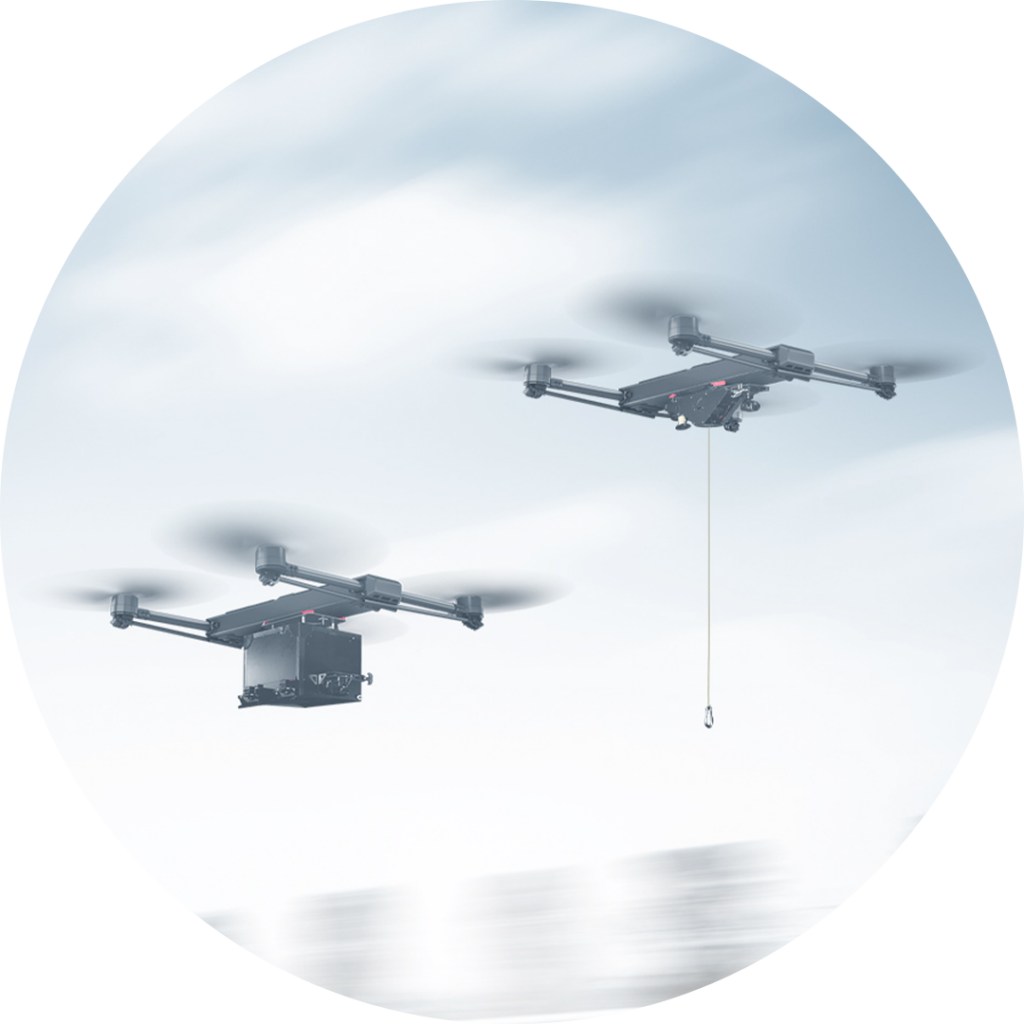
The Future of Drone Delivery
A WORLD WITHIN REACH
Demand for drone hardware and services has never been greater. From emergency medical deliveries to agricultural management; community, government, and corporate drone usage is expected to see enormous growth up to and beyond 2028.