Insurance companies can use Draganfly technology for pre-damage baseline and post-event damage assessments of infrastructure to reduce risk when dealing with natural disasters and other catastrophic events. Property owners, insurers, and reinsurers can leverage our flight, data collection, and assessment services to increase accuracy and speed when inspecting a site.
Our hardware meets stringent design and engineering requirements, which enable our systems to be safely operated and utilized within the national airspace of various countries.
As regulatory environments and UTM solutions evolve, our experienced team is poised to work with airspace administrators, system providers, enterprise clients, and drone operators seeking to mitigate risk as they deploy our RPAS’ for missions that yield real-time situational awareness.
Drones Designed for Risk Management and Damage Assessment Systems
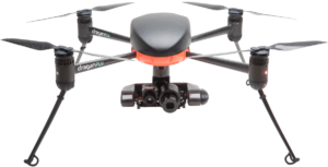
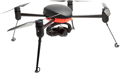
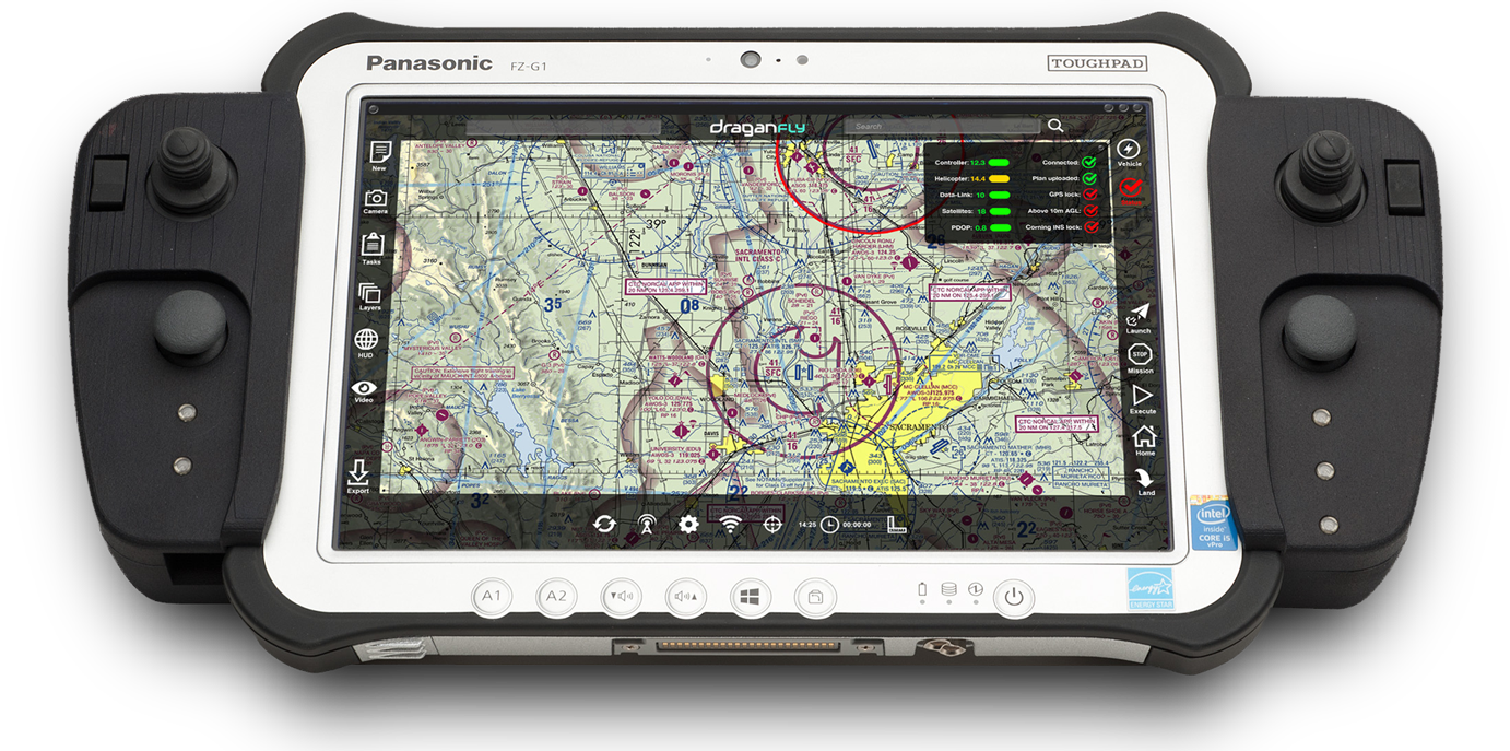
DRAGANFLYER COMMANDER
The Draganflyer Commander is a high-endurance, electric multi-rotor UAV built on our patented carbon fiber folding airframe with interchangeable payloads. The Commander is perfect for high-stress, high-risk applications due to its ease of use and ability to rapidly deploy. This turnkey solution is both manufactured and supported in North America so you can be confident in the integrity of your data and investment.
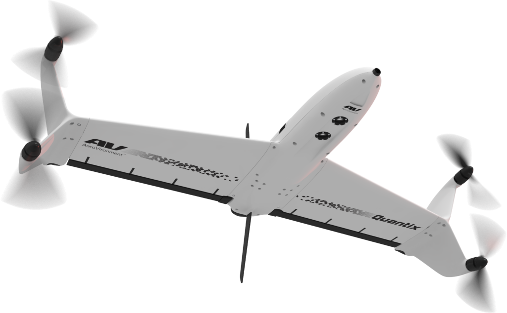
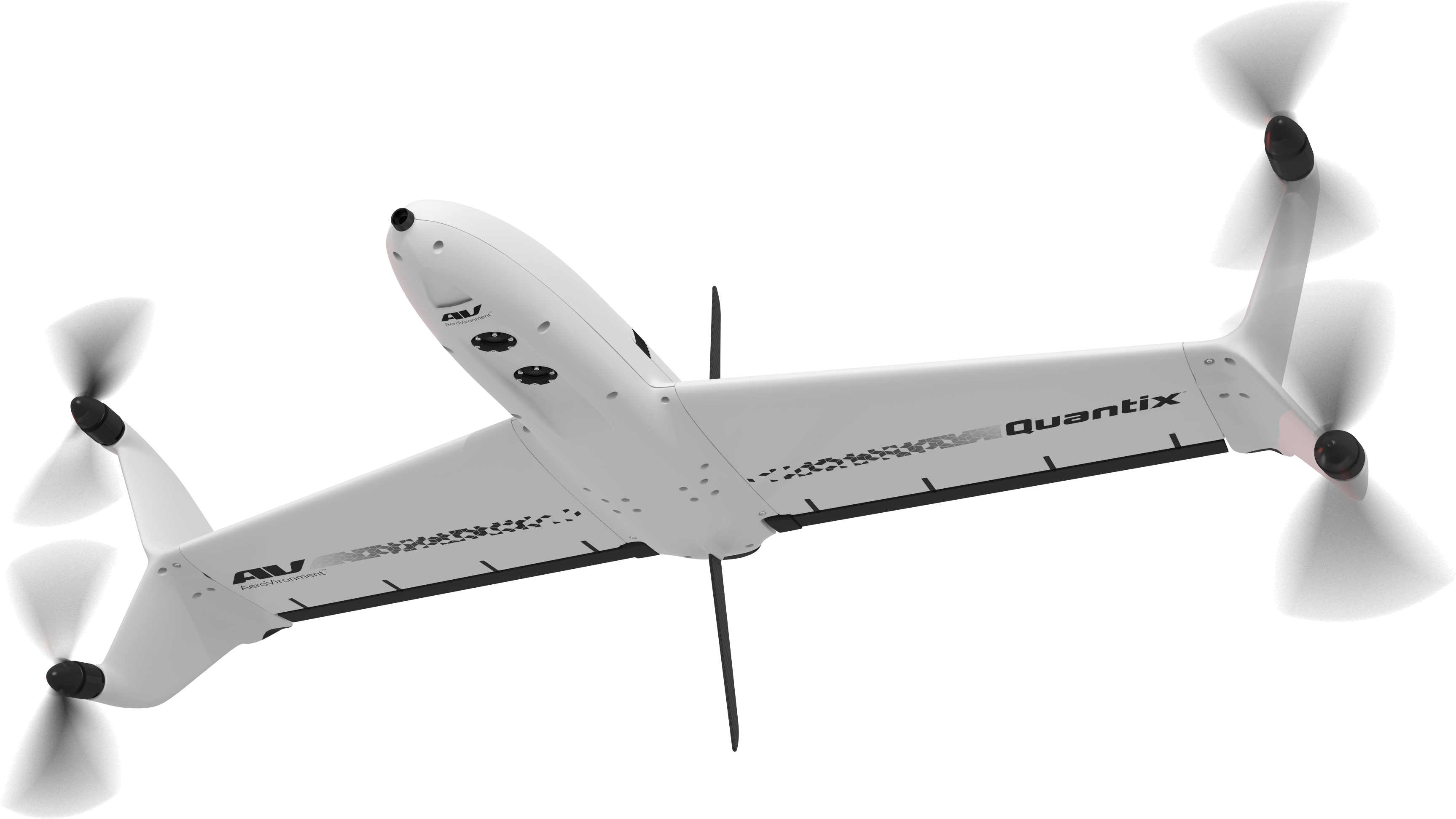
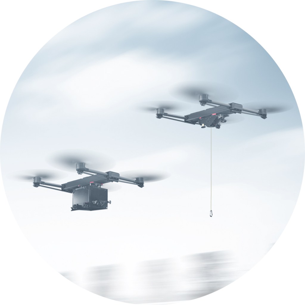
Enjoy the vertical takeoff and landing options of a multi-rotor with the increased coverage area of a fixed wing in a single drone with the Quantix Mapper. This VTOL was designed to be simple to operate and offers 45-minute flight times with 400 acres of coverage per flight.
Turnkey Solutions to Better Understand and Manage Insurance
Infrastructure owners and insurers looking to mitigate risk and inspect property after a natural disaster such as a hurricane, forest fire, or storm can utilize the Draganflyer Commander and Quantix Mapper drones to assess damage. Multispectral sensors are often used in agricultural settings to assess crops to measure the exact number of acres damaged after a hail or wind storm.
Post-catastrophe, the Draganflyer Commander is often used for low, slow, and “close” assessments such as measuring flood damage to houses on a specific residential street. In contrast, the Quantix Mapper is suitable for capturing larger sample sets with a macro view assessment.
Industry sectors with insurance needs that we can support include agriculture, commercial infrastructure, utilities and property / asset owners. Whether a property owner wants to inspect their roof after a storm, a utility company needs to check power lines, or a solar farm is looking to identify broken panels, Draganfly drones allow for better insight into properties, helping to accelerate decision making while decreasing risk.
Quantify the Impact of Natural Disasters
The Pix4D drone software suite is the premiere drone photogrammetry solution for UAV-based data collection. Pix4D transforms aerial photographic data collected into geo-referenced 2D orthomosaics, Digital Terrain Models (DTM), 3D models, and vegetation indices.
This software is especially useful when comparing and overlaying pre- and post-disaster drone data and maps to help insurers make accurate decisions. Rely on our team of data experts to help you manage practical applications of this technology.
Regardless of whether you’re an individual or an enterprise using our systems as data collection tools, you’ll be able to incorporate insights from our systems into your decision making process to assess, analyze, and take more precise action.
Whether you hope to mitigate risk through pre-event use of our drones, or if you need to safely, accurately, and efficiently resolve a post-event claim, we have a solution for you.
Tim Dunnigan is a thought leader and serial entrepreneur who served 22-years in the U.S. Army
as a Soldier, NCO, and Commissioned Officer where he filled a myriad of dynamic leadership
roles and global assignments, including three combat tours of duty. His 20-years of
entrepreneurial success is guided by transformational ideas and ventures in technology,
innovation, and education. Tim is the CEO & Founder at CaptureTec, LLC – a Center for
Verification and Evaluation Certified, Service-Disabled Veteran-Owned Small Business (CVE
SDVOSB) focused on leadership consultation, systems integration, and solutions that provide
data capture for infrastructure assets using aerial, static, and mobile scanning technologies. As
the COO and Co-founder at Talon Aerolytics, Tim architected the nation’s largest aerial drone
services provider from inception to all 50 states serving clients including AT&T, Nokia, T-Mobile,
Ericsson, and Verizon. As the CEO & Founder at Strategic Integration (CVE SDVOSB), Tim
developed the CTED (Create, Test, Educate, Deploy) turnkey business model for defense
consulting and technology integration, while serving America’s interests abroad through multiple
U.S. DoD classified hardware and software contracts in the U.S. and overseas. Additionally, Tim
is the Founder of Innovalearn, where he created education content for clients including Aflac,
Synovus, Subway, and Cox Communications; the Founder of iK9 (CVE SDVOSB), where he
co-authored the Veterans Administration (VA) training protocols for service dogs for Veterans
with PTSD; and the Co-founder of GameLink Lounge, where he architected innovative
entertainment concepts for Service Members and their families on Military installations across
the U.S.
Tim is also the Founder of the I’m a Hero Too Foundation [501(c)(3)] and a children’s book
author. He holds a Bachelor’s Degree in Human Development, a Master’s Degree in
Organizational Leadership and Management, and has completed 2-years of PhD studies in
Adult Education at Auburn University. Tim’s been awarded 6 patents and currently has two
patents pending on an aerial drone delivery system he developed to fill capability gaps he witnessed during his multiple trips to Ukraine.
The Future of Drone Surveillance
SAVING TIME, MONEY, AND LIVES.
Short–range drone surveillance has experienced significant attention thanks to its low cost and efficiency. Long-range drone surveillance beyond visual line of sight (BVLOS) is now on the horizon and is set to amplify cost savings regarding resources and time spent on data collection.
This website uses cookies to improve user experience. By using our website, you consent to all cookies with accordance with our Cookie Policy.
The Future of Drone Delivery
A WORLD WITHIN REACH
Demand for drone hardware and services has never been greater. From emergency medical deliveries to agricultural management; community, government, and corporate drone usage is expected to see enormous growth up to and beyond 2028.