• News
  • Investors

Draganflyer Commander Mapping Package

Surveying, mining, oil and gas, construction, and electric companies use the Draganflyer Commander quadcopter for high-level oversight to avoid putting personnel at risk or shutting down operations.

Drone mapping

Turnkey Solutions for 2D Mapping and 3D Models

  • 35-MIN FLIGHT TIME
    HIGH RESOLUTION RGB 20 MEGAPIXEL CAMERA
    PIX4D MAPPER
Draganfly Commander with mapping payload
Enterprises and rural communities use the Draganflyer Commander for site monitoring, measuring volumetrics, digital surface modeling, fire services, and a wide variety of other use cases. Designed with simultaneous dual video streams from both the FLIR and E/O cameras, our Digital Video Network also features 128bit AES Encrypted, WPA2-CCMP.
Draganfly Commander Mapping Drone

DRAGANFLYER COMMANDER UAV

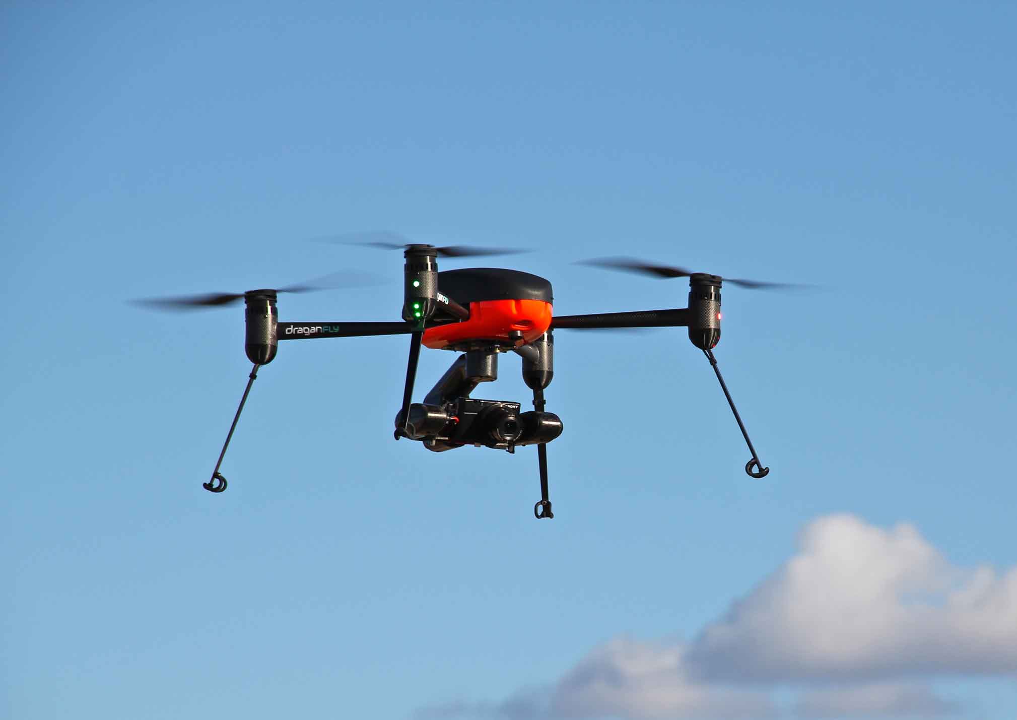
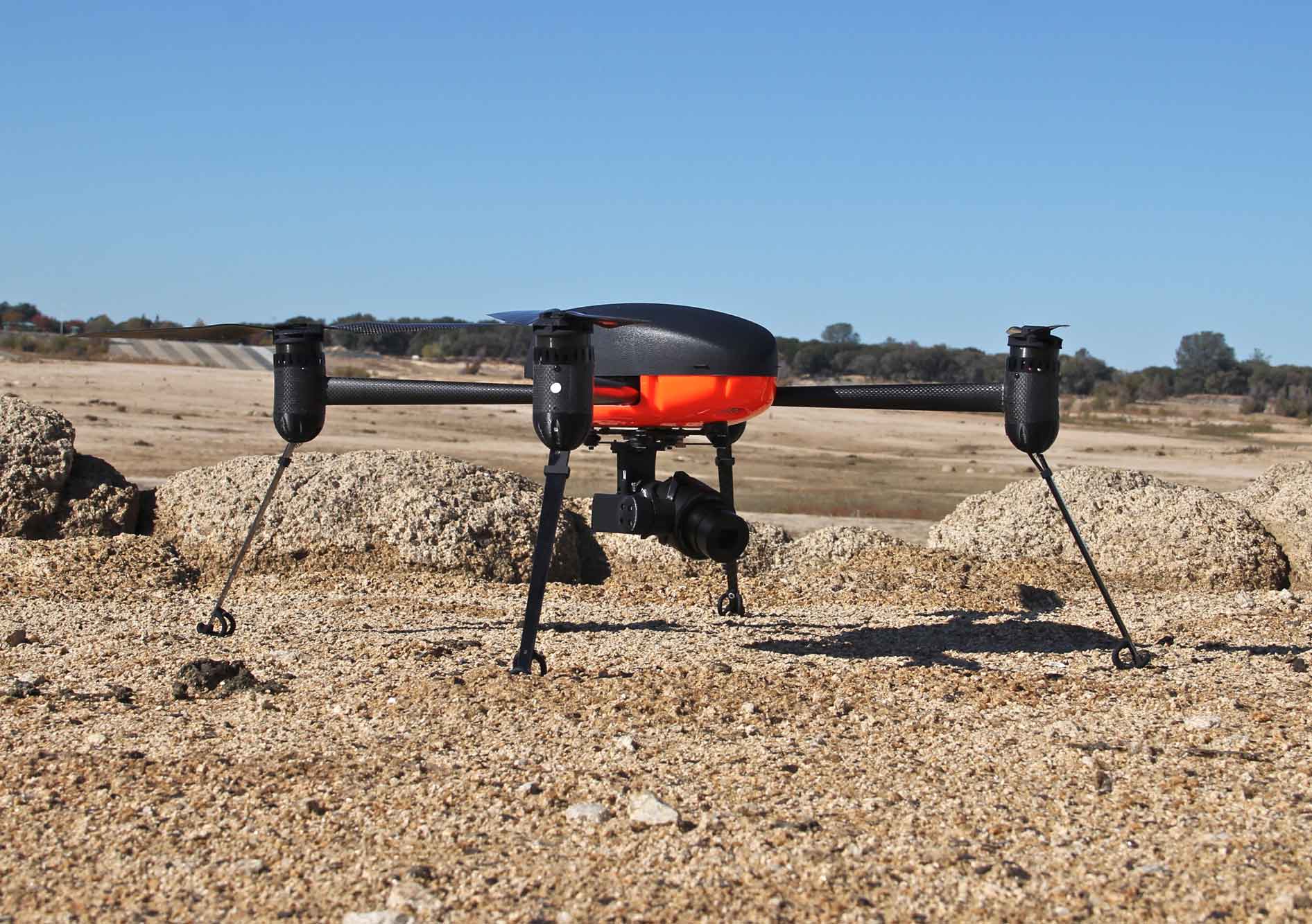
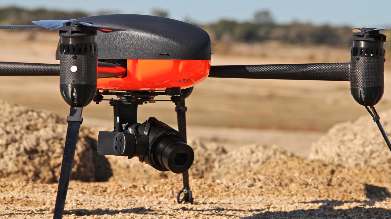
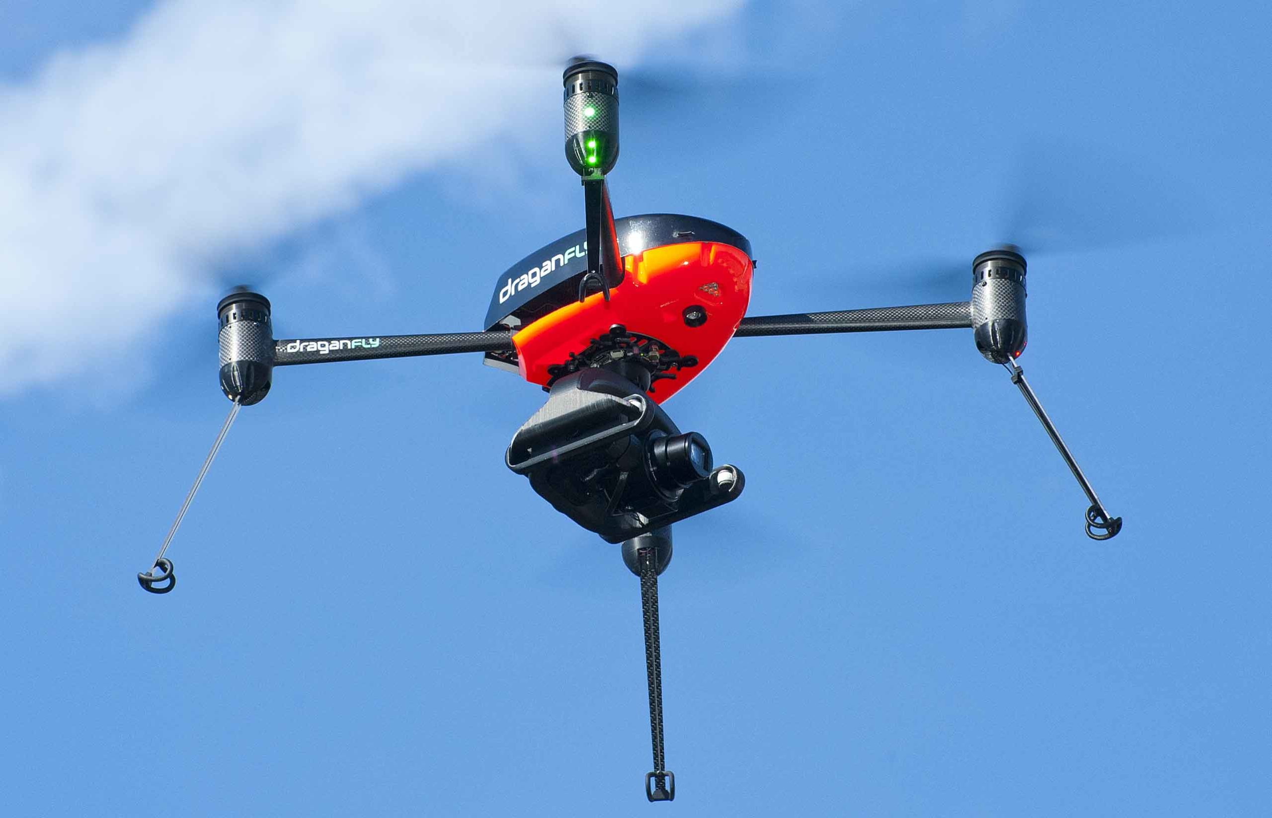
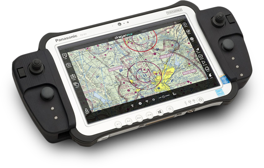
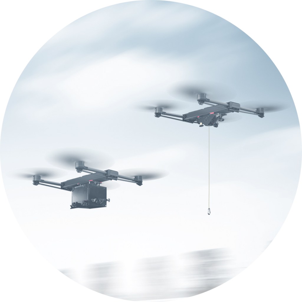
Our high-endurance, electric multirotor UAV built on our patented carbon fiber, folding airframe boasts a dual battery system powering 35-minute flight times, making it ideal for capturing high resolution images during long and low flights. Automated flight planning tools allow you to easily create a coverage area and flight plan driven by your imagery requirements for automatic flight and data collection. This “out-of-the-box” ready solution comes equipped with your airframe, flight planning software to easily and seamlessly collect data, and post-processing mapping software. The Draganflyer Commander also supports multiple payloads and sensors that can be flexibly adapted and easily interchanged between flights. A great solution for novice operators, our highly customizable software allows users to modify everything from overlays to the resolution. You can’t go wrong with this adaptable, easy-to-use, turnkey solution.
Professional Mapping Drone

SERVICE AND SUPPORT YOU CAN TRUST

As an original manufacturer, we have the in-house expertise to consistently provide you unparalleled support to keep your critical systems ready to deploy at a moment’s notice. With a one-year warranty and lifetime product support and service, confidently choose us as your committed partner for enhancing your mapping programs.

Key Features

MADE IN NORTH AMERICA

Each component of the Commander Mapping Package (including the drone, sensor, and flight controller) are North American-manufactured and supported. You can be confident in the integrity of your data and the security of your investment.

ENCRYPTION

The Draganflyer Digital Video Network is 128bit AES Encrypted, WPA2-CCMP. Central to the network is the Digital Base Station, responsible for creating the network to provide connectivity between the helicopter, pilot, and networked observers. AES encryption provides robust security and high performance to deliver high quality video.

These features make the Commander Mapping Package perfect for a diverse array of industries including emergency services, oil and gas, mining, surveying, and construction. This technology can be used in a variety of applications to gain insights into large-scale operations such as site monitoring and collision reconstruction.

Draganfly Universal Control System (UCS)

POST-PROCESSING SOFTWARE

The Pix4D software suite is the premiere photogrammetry solution for UAV-based data collection. Extremely powerful and easy to use, Pix4D’s products create flexible outputs used in countless applications for a wide range of industries including agriculture, mining, environmental monitoring, emergency services, construction, and more!

Pix4D transforms aerial photographic data collected into geo-referenced 2D orthomosaics, Digital Terrain Models (DTM), 3D models, and vegetation indices. Pix4D creates highly accurate models to measure, evaluate, and visually review the data, which can also be exported for use in most other third-party GIS programs. Learn more about our software.

Additional Resources

Draganflyer Commander Technical Specs

Draganfly Surveyor

Available Now

Contact our team to discuss our ready-to-ship, turnkey commercial drones and custom solutions.

Draganflyer Commander2 Info Request

Tim Dunnigan

ADVISOR

Tim Dunnigan is a thought leader and serial entrepreneur who served 22-years in the U.S. Army as a Soldier, NCO, and Commissioned Officer where he filled a myriad of dynamic leadership roles and global assignments, including three combat tours of duty. His 20-years of entrepreneurial success is guided by transformational ideas and ventures in technology, innovation, and education. Tim is the CEO & Founder at CaptureTec, LLC – a Center for Verification and Evaluation Certified, Service-Disabled Veteran-Owned Small Business (CVE SDVOSB) focused on leadership consultation, systems integration, and solutions that provide data capture for infrastructure assets using aerial, static, and mobile scanning technologies. As the COO and Co-founder at Talon Aerolytics, Tim architected the nation’s largest aerial drone services provider from inception to all 50 states serving clients including AT&T, Nokia, T-Mobile, Ericsson, and Verizon. As the CEO & Founder at Strategic Integration (CVE SDVOSB), Tim developed the CTED (Create, Test, Educate, Deploy) turnkey business model for defense consulting and technology integration, while serving America’s interests abroad through multiple U.S. DoD classified hardware and software contracts in the U.S. and overseas. Additionally, Tim is the Founder of Innovalearn, where he created education content for clients including Aflac, Synovus, Subway, and Cox Communications; the Founder of iK9 (CVE SDVOSB), where he co-authored the Veterans Administration (VA) training protocols for service dogs for Veterans with PTSD; and the Co-founder of GameLink Lounge, where he architected innovative entertainment concepts for Service Members and their families on Military installations across the U.S.

Tim is also the Founder of the I’m a Hero Too Foundation [501(c)(3)] and a children’s book author. He holds a Bachelor’s Degree in Human Development, a Master’s Degree in Organizational Leadership and Management, and has completed 2-years of PhD studies in Adult Education at Auburn University. Tim’s been awarded 6 patents and currently has two patents pending on an aerial drone delivery system he developed to fill capability gaps he witnessed during his multiple trips to Ukraine.

The Future of Drone Surveillance

SAVING TIME, MONEY, AND LIVES.

Short–range drone surveillance has experienced significant attention thanks to its low cost and efficiency. Long-range drone surveillance beyond visual line of sight (BVLOS) is now on the horizon and is set to amplify cost savings regarding resources and time spent on data collection.
This website uses cookies to improve user experience. By using our website, you consent to all cookies with accordance with our Cookie Policy.

The Future of Drone Delivery

A WORLD WITHIN REACH

Demand for drone hardware and services has never been greater. From emergency medical deliveries to agricultural management; community, government, and corporate drone usage is expected to see enormous growth up to and beyond 2028.