We develop and build unmanned aircraft for a wide range of applications, but we also realize that these are just flying machines and data collection is your top priority.
The real value in UAV systems comes from high-quality sensors as they play a critical role in ensuring that the unmanned systems work properly, meet the requirements of the target application, provide and increase their navigation capabilities, and suitably monitor and gain information on several physical quantities in the environment around them.
Industry-Leading Technology
We partner with the best sensor manufacturers globally and integrate a diverse range of sensors and cameras into our OEM and third-party drone infrastructure to support unique use cases.
We wholeheartedly believe that there is a perfect tool for every job out there. We are proud to work with industry leaders in remote sensing to create turnkey solutions to meet your specific needs.
High Resolution RGB
Our camera partners offer sensors ranging from 18MP to 100MP color visual light still cameras intended for broad use cases such as agriculture, surveying, public safety, and infrastructure inspection. These cameras are tightly integrated and ideal for applications when high spatial accuracy is important to provide you a real time overview of your scene. This technology is also perfect for capturing high resolution imagery for post processing and analysis.
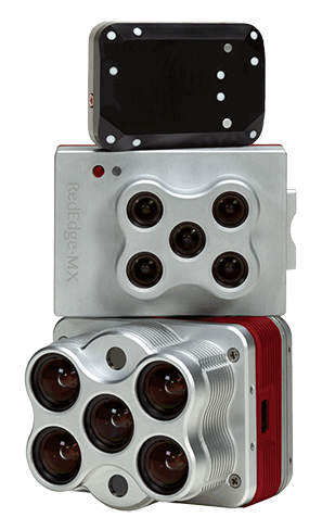
Multispectral
These specialty cameras are tightly integrated with our RPAS platforms and flight planning software to accurately capture imagery in specific targeted light bands. We work with industry leaders including MicaSense, Tetracam, StantRange, and others to engineer the perfect solution for each unique use case. Particularly useful in the agricultural industry, these cameras allow researchers, breeders, and producers to capture the spectral range and resolution needed to calculate vegetation indices (VIs) for monitoring crop health, growth, and biomass. We offer and support a range of multispectral sensors to fit your operations with both passive and stabilized gimbal mounting options.
Hyperspectral
Offering a much wider spectral range than multispectral cameras, these line scanning sensors provide users extremely fine spectral resolution to target multiple user defined, narrow light bands. Hyperspectral sensors find practical use cases in agricultural phenotyping research, environmental monitoring, and inspections for the energy sector. We support and offer hyperspectral imagers on multiple UAV platforms with passive and stabilized gimbal mounting options.
LiDAR
Light Detection and Ranging (LiDAR) provides extremely accurate distance measurements and improved resolution over conventional photogrammetry methods. Often used for mapping and surveying, this sensor works well when there is dense ground cover or tree canopy. Please note that this system is generally large which will require a heavy-lift UAV platform.
Thermal Infrared
Particularly useful in the agricultural industry, these cameras allow researchers, breeders, and producers to capture the spectral range and resolution needed to calculate vegetation indices (VIs) for monitoring crop health, growth, and biomass. Commonly used by emergency response teams and for infrastructure inspection, thermal infrared cameras give invaluable information for search and rescue, fire response and management, and identifying damaged energy sector infrastructure. We offer thermal infrared cameras installed stand alone or alongside RGB visual light sensors to simultaneously capture thermal and visual data. Thermal Infrared sensors are integrated on stabilized gimbal mounts.
Magnetometer
Used to survey fine geomagnetic variations to identify potential underground mineral deposits and buried ferrous metals, magnetometers are important tools for archaeology, geological exploration, and energy infrastructure inspection.
Custom Payloads
If you don’t see the sensor for the data collection you need, please get in touch! Our team will be happy to work with you to design and develop a custom solution to efficiently capture your niche dataset from the air.
Reach out to a Sales Specialist today to learn more about our Custom Solutions.
Reach out to a Sales Specialist today to learn more about our Custom Solutions.
Contact our team to discuss our ready-to-ship, turnkey commercial drones and custom solutions.
Tim Dunnigan
ADVISOR
Tim Dunnigan is a thought leader and serial entrepreneur who served 22-years in the U.S. Army
as a Soldier, NCO, and Commissioned Officer where he filled a myriad of dynamic leadership
roles and global assignments, including three combat tours of duty. His 20-years of
entrepreneurial success is guided by transformational ideas and ventures in technology,
innovation, and education. Tim is the CEO & Founder at CaptureTec, LLC – a Center for
Verification and Evaluation Certified, Service-Disabled Veteran-Owned Small Business (CVE
SDVOSB) focused on leadership consultation, systems integration, and solutions that provide
data capture for infrastructure assets using aerial, static, and mobile scanning technologies. As
the COO and Co-founder at Talon Aerolytics, Tim architected the nation’s largest aerial drone
services provider from inception to all 50 states serving clients including AT&T, Nokia, T-Mobile,
Ericsson, and Verizon. As the CEO & Founder at Strategic Integration (CVE SDVOSB), Tim
developed the CTED (Create, Test, Educate, Deploy) turnkey business model for defense
consulting and technology integration, while serving America’s interests abroad through multiple
U.S. DoD classified hardware and software contracts in the U.S. and overseas. Additionally, Tim
is the Founder of Innovalearn, where he created education content for clients including Aflac,
Synovus, Subway, and Cox Communications; the Founder of iK9 (CVE SDVOSB), where he
co-authored the Veterans Administration (VA) training protocols for service dogs for Veterans
with PTSD; and the Co-founder of GameLink Lounge, where he architected innovative
entertainment concepts for Service Members and their families on Military installations across
the U.S.
Tim is also the Founder of the I’m a Hero Too Foundation [501(c)(3)] and a children’s book
author. He holds a Bachelor’s Degree in Human Development, a Master’s Degree in
Organizational Leadership and Management, and has completed 2-years of PhD studies in
Adult Education at Auburn University. Tim’s been awarded 6 patents and currently has two
patents pending on an aerial drone delivery system he developed to fill capability gaps he witnessed during his multiple trips to Ukraine.
The Future of Drone Surveillance
SAVING TIME, MONEY, AND LIVES.
Short–range drone surveillance has experienced significant attention thanks to its low cost and efficiency. Long-range drone surveillance beyond visual line of sight (BVLOS) is now on the horizon and is set to amplify cost savings regarding resources and time spent on data collection.
This website uses cookies to improve user experience. By using our website, you consent to all cookies with accordance with our Cookie Policy.
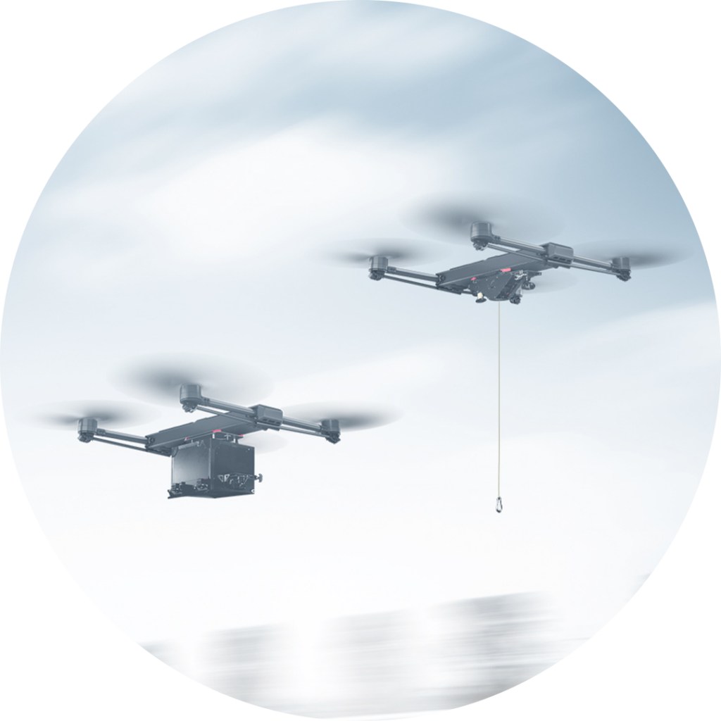
The Future of Drone Delivery
A WORLD WITHIN REACH
Demand for drone hardware and services has never been greater. From emergency medical deliveries to agricultural management; community, government, and corporate drone usage is expected to see enormous growth up to and beyond 2028.