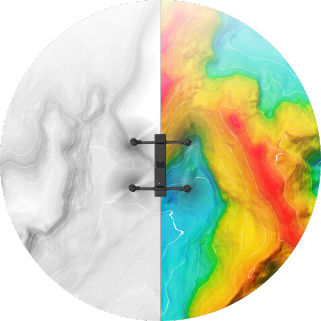

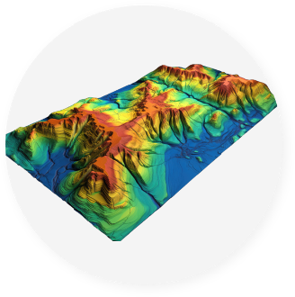
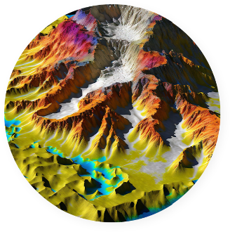
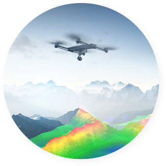
Our teams can capture aerial imagery and data that can be used to create detailed topographic maps, which are essential in various industries such as civil engineering, construction, urban planning, and land management. Drones can quickly and efficiently capture data over large areas, including elevation, contour lines, and features such as roads, rivers, and buildings, which can be used to create accurate and up-to-date topographic maps.
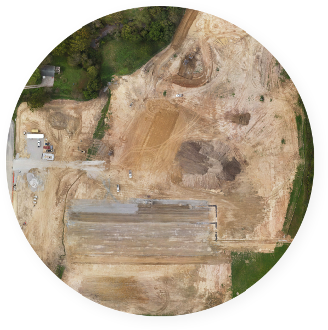
Our teams can capture overlapping aerial images that can be stitched together to create high-resolution orthomosaic maps. Orthomosaics are maps that are geometrically corrected to remove distortions and scale the imagery accurately, resulting in maps that are true to scale and can be used for precise measurements and analysis. These digital maps are commonly used in agriculture, land management, infrastructure planning, and environmental monitoring.
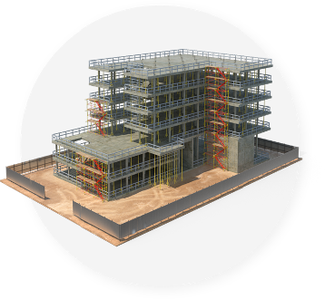
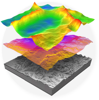
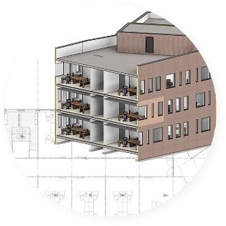
Our teams can capture data that can be used to create 3D models of landscapes, buildings, and other objects. Using point cloud data, and specialized software, the data captured by the drone can be processed to generate accurate and detailed 3D models, which can be used for visualization, analysis, and design purposes. 3D modeling with drones is used in industries such as architecture, construction, real estate, and cultural heritage preservation.
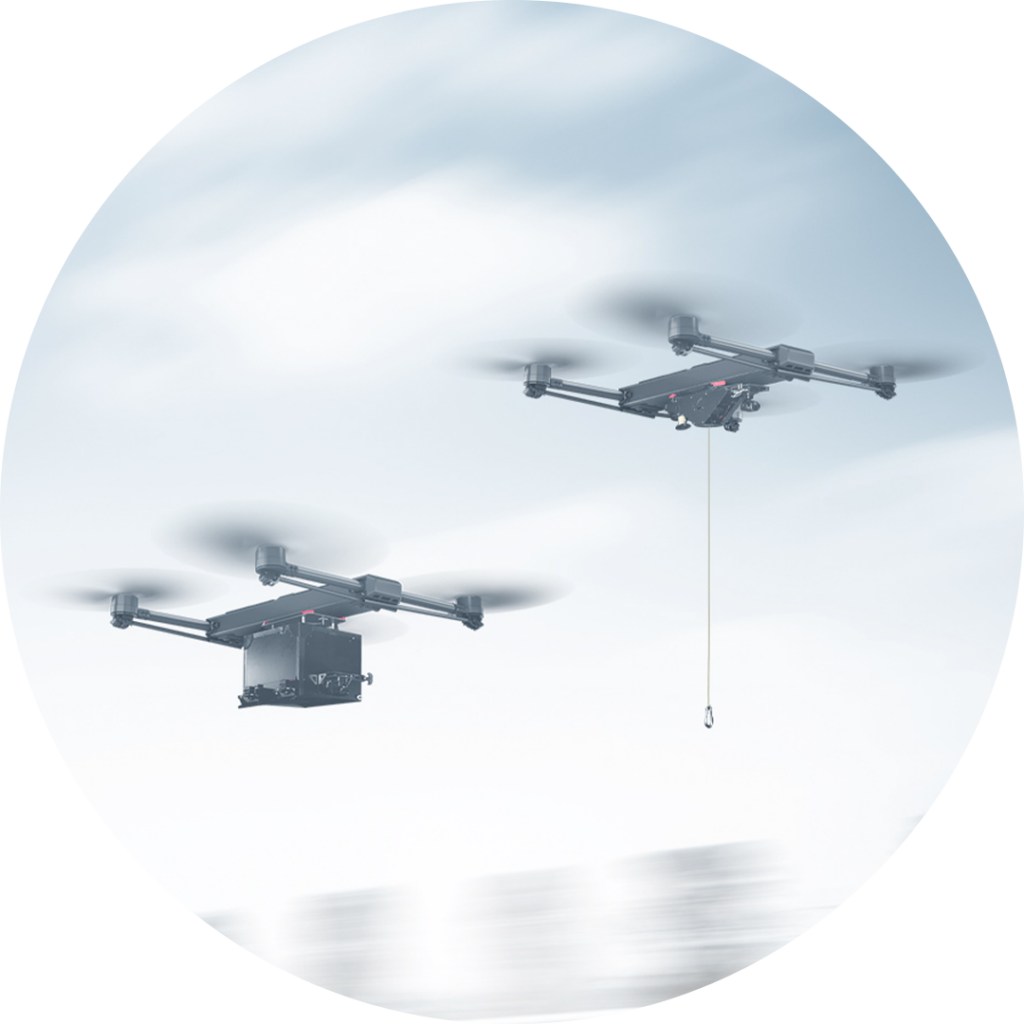
Our teams can collect various data types during mapping and surveying missions, including aerial imagery, LiDAR data, thermal data, and multispectral data. These data can be used for various applications, such as land surveying, infrastructure inspection, environmental monitoring, and asset management. Drones can collect data more efficiently and cost- effectively compared to traditional surveying methods, reducing the need for manual measurements and site visits.
Our teams can integrate with GIS software, which is used for capturing, storing, analyzing, and managing geospatial data. The data captured by drones can be imported into GIS software, where it can be processed, analyzed, and visualized to create maps, perform spatial analysis, and make informed decisions in various industries and applications.
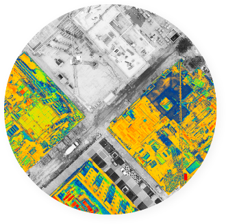
Our teams can capture aerial imagery and data that can be used to create detailed topographic maps, which are essential in various industries such as civil engineering, construction, urban planning, and land management. Drones can quickly and efficiently capture data over large areas, including elevation, contour lines, and features such as roads, rivers, and buildings, which can be used to create accurate and up-to-date topographic maps.
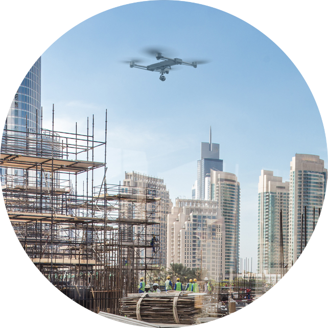
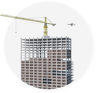
Our team captures aerial imagery or video footage of construction sites, which can be used for project visualization, communication, and stakeholder engagement. Drones can provide a bird's-eye view of the construction site, showing the project's scale, scope, and progress, and help with project presentations, marketing, and client communication.
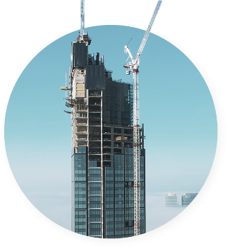
Our team uses drones to inspect construction sites, buildings, structures, roofs, facades, and other hard-to-reach areas for safety, quality, and compliance. Drones equipped with cameras or sensors can capture high-resolution imagery, thermal data, or other data to detect potential issues, such as cracks, leaks, or structural damage, and enable proactive maintenance and repairs.
Our teams monitor and document construction progress over time, capturing visual data of the site and construction activities at different project stages. Drones can provide regular updates on construction progress, identify delays, and support project management and scheduling.
Our teams use drones to measure earthworks, such as cut and fill volumes, stockpile volumes, and material movement on construction sites. Drones equipped with LIDAR or photogrammetry sensors can generate accurate and timely data for earthworks calculations, material management, and cost estimation.
Our teams use drones to help create as-built documentation of completed construction projects, capturing aerial imagery and data for record-keeping, documentation, and compliance. Drones can provide an efficient and accurate means of creating as-built records, which can be used for facility management, maintenance, and asset management.
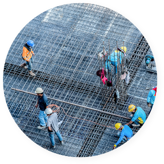
Our team uses drones for safety inspections, such as inspecting high-risk or hazardous areas, equipment, or structures, without exposing personnel to potential risks. Drones can also be used for risk management, such as identifying potential safety hazards, monitoring site conditions, and supporting safety protocols and compliance.
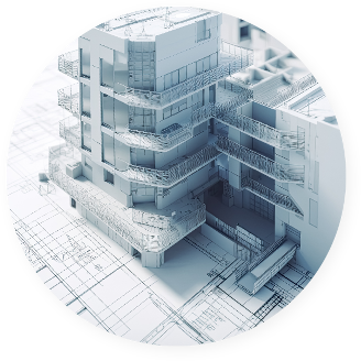
Our team uses drones to support the design and visualization of construction projects, providing aerial data for site analysis, site planning, and design optimization.
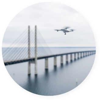
Our teams can inspect bridges for signs of damage, wear, or other structural issues without requiring human inspectors to access potentially dangerous or hard-to-reach areas physically. Drones can capture high-resolution images and videos of bridge components, such as decks, piers, abutments, and cables, which can be used for visual inspection, condition assessment, and maintenance planning.
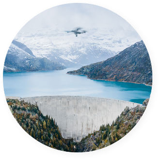
Our teams can inspect dams and reservoirs for erosion, cracks, leaks, and other potential issues. Drones can fly close to the dam's surface and capture high-resolution images and videos, which can be used to assess the dam's condition, detect any signs of distress, and monitor changes over time.
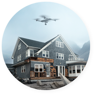
Our teams can inspect rooftops and buildings for maintenance, safety, and structural issues. Drones can capture images and videos of rooftops, facades, chimneys, and other building components, which can be used to identify cracks, leaks, or other damage, assess the condition of building envelopes, and plan maintenance or repairs.
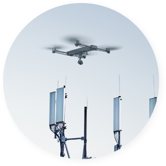
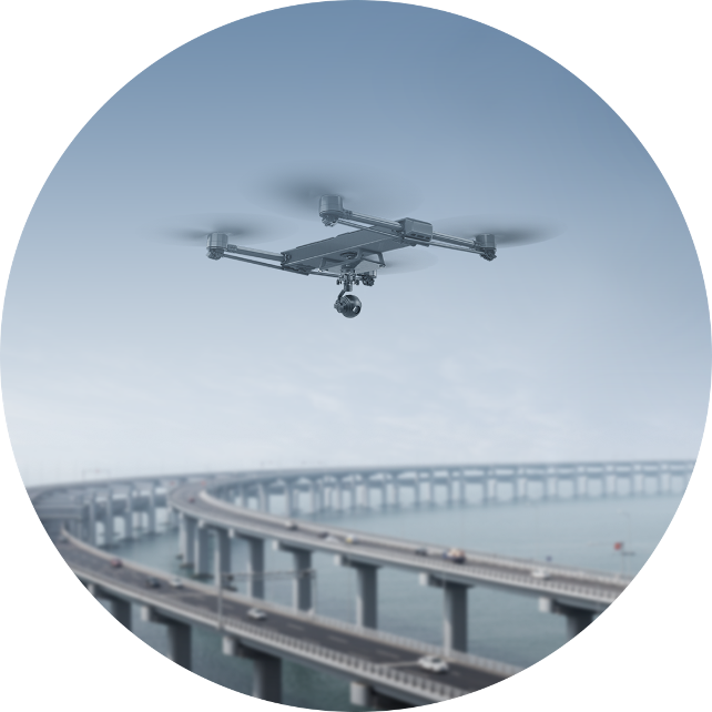
Our teams can inspect various other types of infrastructure, such as towers, antennas, railways, highways, tunnels, and more. Drones can access hard-to-reach areas, capture visual and sensor data, and provide valuable information for inspection, assessment, and maintenance purposes.
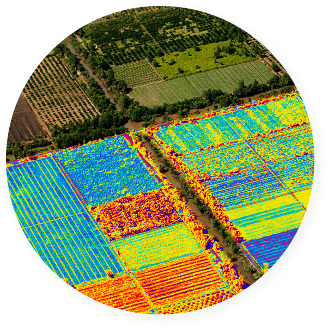
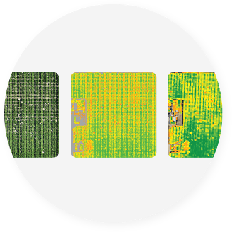
Our team uses drones equipped with multispectral or hyperspectral sensors to capture high-resolution imagery of crops, allowing farmers to monitor the health and vigor of their crops. By analyzing the imagery, farmers can detect early signs of plant stress, nutrient deficiencies, pest and disease infestations, and other crop-related issues, which can be used to help take timely corrective actions.
Our team uses drones to help implement precision agriculture techniques by collecting data on soil moisture, nutrient levels, and other field parameters. This data can be used to create prescription maps for variable rate application of fertilizers, pesticides, and irrigation, optimizing resource use, reducing input costs, and maximizing crop yields.
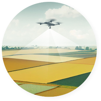
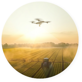
Our teams can quickly and efficiently scout large agricultural fields, providing farmers with an aerial perspective to identify potential issues such as uneven crop growth, weed infestations, or disease outbreaks. This can help farmers make informed decisions on crop management practices and optimize field operations.
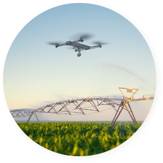
Our teams use drones to monitor irrigation systems and provide information on soil moisture levels, crop water stress, and water distribution uniformity. This can help farmers optimize irrigation schedules, reduce water waste, and improve water use efficiency.
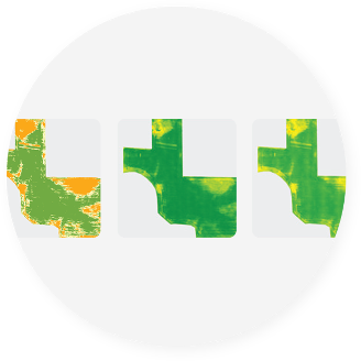
Our team uses drones to capture high-resolution imagery of agricultural fields, which can be used to create orthomosaic maps, digital elevation models (DEMs), and vegetation indices. These maps can provide valuable information on crop health, growth patterns, and field variability, which can aid in crop management decisions.
Our team can use drones to monitor and manage pests and diseases in crops. Drones can quickly detect pest and disease outbreaks, and targeted pesticide application can be done using drones, reducing the need for broad-spectrum chemical treatments and minimizing environmental impact.
Our team can use drones to create accurate maps of crop acreage, plant populations, and crop inventory. This information can be used for crop insurance, compliance reporting, and financial planning purposes.
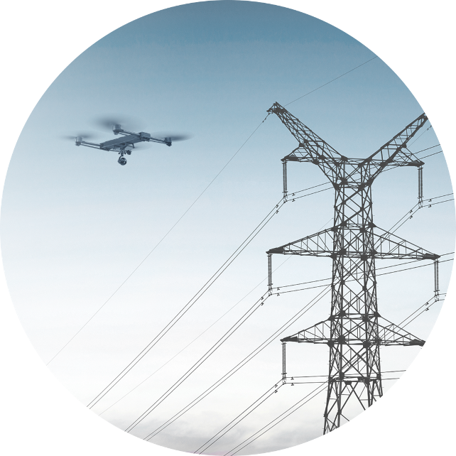
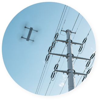
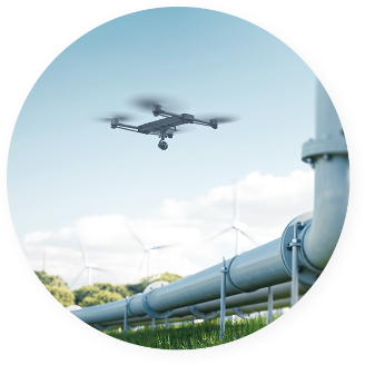
Our team visually inspects utility lines, transmission towers, substations, transformers, and other related infrastructure. Our systems can capture imagery of power lines and associated components, allowing inspectors to remotely assess their condition, identify signs of wear, damage, or other issues, and plan maintenance or repairs.
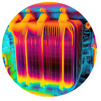
Our teams utilize drones equipped with thermal cameras that can capture thermal imagery of utility lines and equipment. This allows for the detection of hotspots, which may indicate potential issues such as overloaded circuits, loose connections, or equipment malfunction. Thermal inspections with drones can help identify and address problems before they lead to more significant failures or outages.
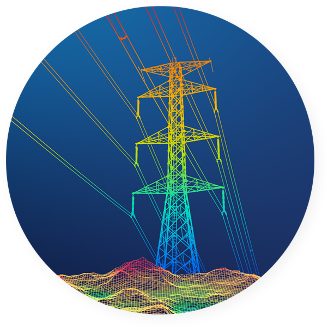
Our teams use drones equipped with LiDAR sensors to capture 3D point cloud data of utility lines and surrounding vegetation or terrain. LiDAR data can provide detailed and accurate information about the physical characteristics of the utility infrastructure, such as line sag, clearance, and vegetation encroachment. This data can be used for precise measurements, accurate modelling, and analytics to support maintenance and planning efforts.
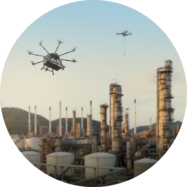
Our team uses drones equipped with high-resolution cameras that can visually inspect gas pipelines, including above-ground pipelines, compressor stations, valve stations, and other associated infrastructure. Our drones can capture imagery of the pipelines and related components, allowing inspectors to remotely assess their condition, identify signs of corrosion, damage, leaks, or other issues, and plan maintenance or repairs.
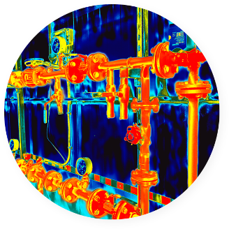
Our teams use drones equipped with thermal cameras to capture gas pipeline and associated equipment thermal imagery. This allows for the detection of hotspots or temperature anomalies, which may indicate potential issues such as equipment malfunction, insulation problems, or gas leaks. Thermal inspections with drones can help identify and address problems before they lead to more significant failures or safety hazards.
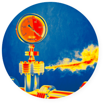
Our teams use drones with specialized sensors such as gas detectors or optical gas imaging (OGI) cameras to detect and visualize gas leaks from pipelines. These sensors can identify emissions of methane or other gases, which can be indicative of leaks in the pipeline or associated equipment. Drones can quickly and efficiently fly along the pipeline route, scanning for gas leaks, and provide real-time data to inspectors for timely action.
Our teams use drones equipped with LiDAR sensors to capture 3D point cloud data of gas pipelines and surrounding terrain. LiDAR data can provide detailed and accurate information about the physical characteristics of the pipeline, such as its location, elevation, alignment, and vegetation encroachment. This data can be used for precise measurements, accurate modelling, and analytics to support maintenance and planning efforts.
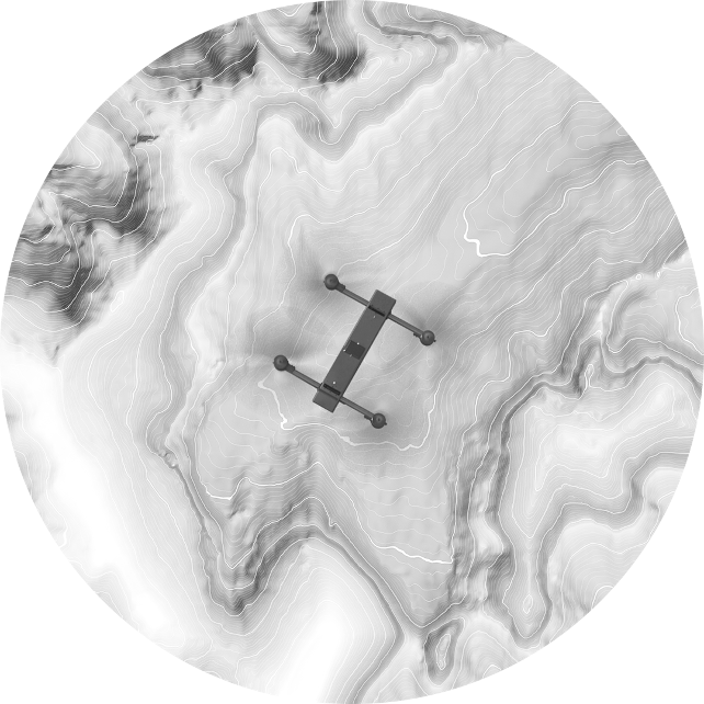
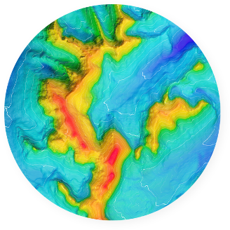
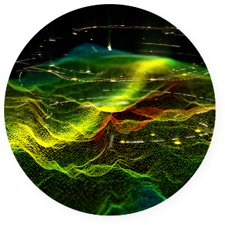
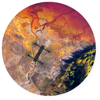
Magnetometer surveys measure the magnetic field intensity and direction at different points in the surveyed area. This data is typically presented as magnetic anomaly maps, contour maps, or point data, and provides information on the spatial distribution of magnetic field values.
Magnetometer surveys can identify magnetic anomalies, which are variations in the magnetic field intensity that deviate from the expected or background magnetic field values. These anomalies can indicate the presence of subsurface features, such as buried objects, mineral deposits, geological structures, or archaeological artifacts.
Magnetometer surveys can help locate potential targets of interest, such as buried metallic objects, mineral deposits, or archaeological artifacts. By mapping and analyzing magnetic anomalies, surveyors can identify areas with high magnetic contrasts or anomalies that may indicate the presence of targets.

Magnetometer surveys can provide information about the geological characteristics of the surveyed area. For example, magnetic data can help identify rock formations, fault lines, or other geological structures that may be associated with certain types of mineral deposits or other subsurface features.
Magnetometer data can be integrated with other survey data, such as aerial photography, LiDAR, or multispectral imaging, to provide a more comprehensive understanding of the surveyed area. This integration can help identify correlations or patterns between different data types, which can enhance the interpretation and analysis of the survey results.
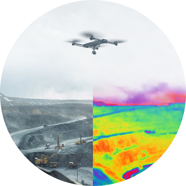
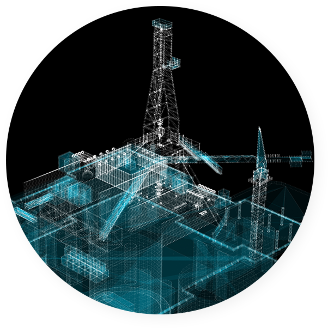
Our team uses drones equipped with high-resolution cameras, LIDAR, or other sensors that can quickly and accurately survey mining sites, capture detailed topographic and geospatial data, and create digital elevation models (DEMs) ororthomosaic maps. This data can be used for mine planning, design, and monitoring, as well as for compliance reporting and documentation.
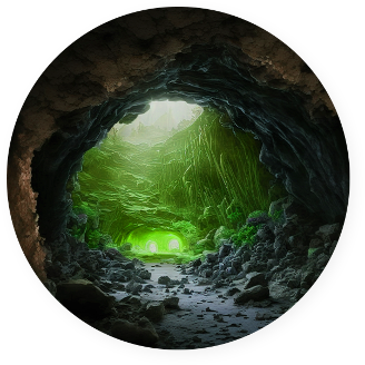
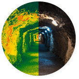
Our team uses HoverMap to map underground mines and generate 3D point clouds, digital terrain models (DTMs), and orthomosaics of complex and challenging environments, such as underground tunnels and voids.
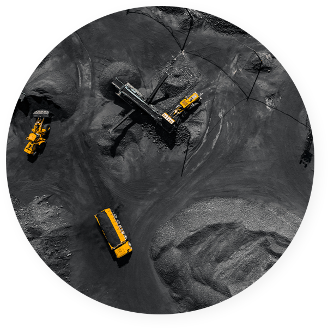
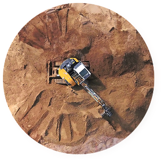
Our team uses drones to conduct volumetric measurements of stockpiles of minerals, ores, or waste materials, providing accurate and efficient stockpile management. This can help mining companies optimize material inventory, track stockpile changes over time, and monitor for potential safety hazards, such as stockpile instability or erosion.
Our team can inspect mining site infrastructure, including slopes, embankments, walls, and structures, for geotechnical stability and integrity. Drones equipped with cameras or sensors can capture high-resolution imagery, thermal data, or other data to assess potential risks, monitor changes, and identify areas that require maintenance or remediation.
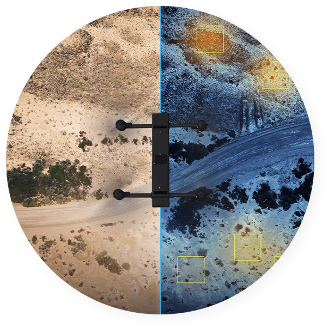
Our team can use drones to monitor and assess the environmental impacts of mining activities, including water quality, air quality, soil erosion, habitat disruption, and vegetation health. Drones can collect data from remote or inaccessible areas, providing a cost-effective and efficient means of environmental monitoring and compliance reporting.
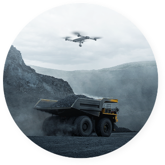
Our team can use drones to inspect mining equipment and assets, such as haul trucks, excavators, crushers, conveyors, and processing plants, for maintenance, performance, and safety. Our systems can capture visual, thermal, or other data to detect potential issues, optimize maintenance schedules, and improve equipment reliability and uptime.
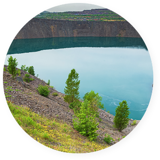
Our team can monitor and assess mine reclamation and rehabilitation efforts, including vegetation growth, soil stability, and hydrological features. Drones can regularly monitor and document reclamation progress, compliance reporting, and restoration planning.

Our team uses HoverMap to enable our drones to fly in GPS-denied environments, including dense forests, underground or internal mining sites, Internal infrastructure, and much more.